
Mastic Peninsula
Historical Society
Est. 1999 · Mastic, New York
A journey through the history of Moriches, Mastic, Mastic Beach, and Shirley — the Tri-Hamlet communities of Long Island's South Shore.
Our Heritage
The Mastic Peninsula juts into Moriches Bay along Long Island's South Shore. For thousands of years it was home to the Unkechaug Nation. European settlement followed in the 17th century, bringing farmers, fishermen, and seafarers. The area grew slowly — defined by its waterways, its land, and the tight-knit families who worked both. Today the Tri-Hamlet communities of Mastic, Mastic Beach, and Shirley carry on that legacy.
Much of this history has been lost. The Mastic Peninsula Historical Society exists to find, document, and preserve what remains.
Through the Years
Pre-Contact Era
The Mastic Peninsula and surrounding waterways were home to the Unkechaug people for thousands of years before European arrival. The Unkechaug, known as the "People of the Cove," relied on the rich marine life of Moriches Bay and the fertile land of Long Island's South Shore.
Start
Native American tribes, The Algonquin flourish on Long Island.
1600s
English settlers arrived on Long Island's South Shore, establishing farms and homesteads. The Mastic area's abundant natural resources — fish, game, timber, and fertile soil — made it an attractive location for early colonists.
1600
European explorers arrive in the “New Land”, Henry Hudson arrives at Long Island in 1609. The Dutch settle the western end, while the British settle in the eastern regions.
1640
Americas Colonial whaling industry begins on the shores of Long Island in the area of Southampton. Soon after, Brookhaven settlers would hunt and process whales of the shore of Fireplace. Now known as Brookhaven Hamlet.
1655
Brookhaven township is established by a small group of English settlers and the whaling industry promotes growth. “Old Town Road”, likely a native American trail, is created to move settlers from Setauket south through Coram and ends in FirePlace. Now Brookhaven Hamlet, just to the west of the Mastic Salt Hay fields.
1657
Richard Woodhull makes the first purchase of land on behalf of the town from local Native Americans. The purchase covers two necks of land on the Mastic Peninsula.
1664
The "Old Purchase at South” was made from Tobaccos, a chief of the Unchechaug Nation, which included the western part of South Haven, Brookhaven and Bellport. This was purchased from the Natives for four coats and about $16 in cash, and the deed is still among the town papers at Brookhaven Town Hall. In addition to getting hay in this part of the town, men came here from the north side settlements to go whaling at an early date, as the oil could be used in their lamps and whalebone was a versatile material. –Thomas R Bayles,
1691
On May 25, 1691 Col. William "Tangier" Smith purchased from the Native, John Mayhew, the enormous acreage, later to be known as the Manor of St. George.
1700s
Large land holdings and estates shaped the landscape of the Mastic area during the colonial and early American period. Farming, fishing, and small-scale industry sustained local families through the 18th century.
1700
William "Tangier" Smith sets aside 175 acres of the land occupied by the Unkechaug Nation on the west side of the Mastic (Forge) River at Poosepatuck Creek to be theirs for the annual rent of two ears of corn. The Poosepatuck Native Reservation is still in existence today, however it has shrunk to 55 acres due to unscrupulous land dealings by early officials. –by Van R. Field Illustrated History of Moriches Bay Area
1705
Major William Henry Smith, 2nd eldest son, inherits The Manor of St. George upon the death of William "Tangier" Smith. The Setauket estate known as St. George Manor is inherited by his eldest son Colonel Henry Smith.
1709
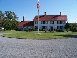
The Manor House at St. George is built for William Henry Smith. The original Patent was granted in 1693. The house would later be seized by the British during the American Revolution. The British were defeated there in 1780 by Col. Benjamin Talmadge. The Smith family returned to the Manor after the war. The Manor in all its splendor still exists today as a museum and is open for weekend tours between May and October.
1717
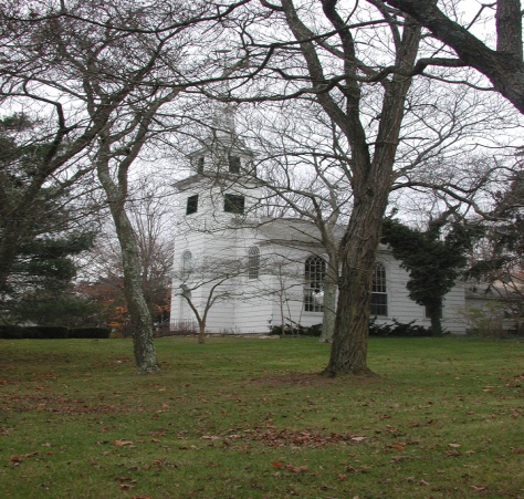
The Old South Haven Presbyterian Church is established and attended through the years by area residents such as the Floyds, General Nathaniel Woodhull, Judge William Smith and Colonel Josiah Smith. The church would later be moved in 1960 to its current location at the corner of South Country Road and Beaver Dam Road in Brookhaven.
1718
Richard Floyd ll purchases over 4400 acres of property from William Tangier Smith of the Manor of St. George. The property stretched six miles north from Moriches Bay and approximately one mile west from the Mastic or Forge River. It included use rights for the Great South Beach on what is now known as Fire Island. Richard Floyd II gave this property to his youngest son, Nicoll Floyd.
1722
Famous Revolutionary Patriot Nathaniel Woodhull is born at the first Richard Woodhull estate, located between Hemlock and Daisy Drive on the south side of Neighborhood Road. Destroyed by fire April 5, 1784...(Ken Spooner), second home (pictured below) would be built by his wife at the corner of Corn Ct. and Washington Drive.

1724
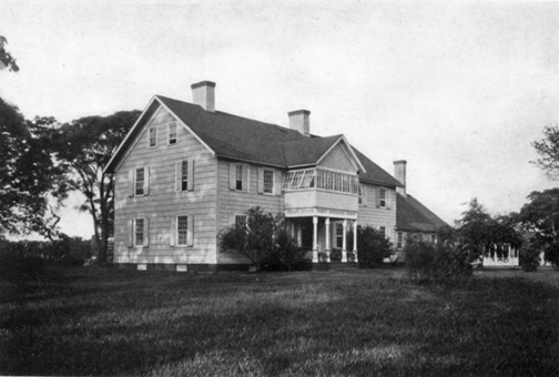
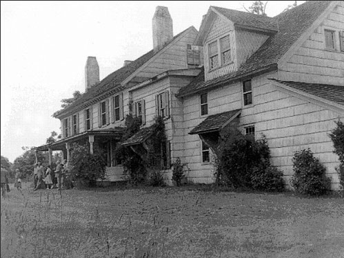
Nicoll Floyd, Father of William Floyd, moves onto the property and builds the first part of the estate, also referred to as "The Old Mastic House". The original home was a two story, six room shingled wood frame house. He developed the land into a prosperous plantation, using both slave and free laborers to raise grain, flax, sheep and cattle.
1734
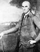
William Floyd, delegate and signer of the Declaration of Independence, is born on December 17th in Brookhaven, NY.
1738
Construction of the first road through Mastic is complete and leads to the Manor of St. George. This same road would later be used by Col. Benjamin Talmadge during the raid on the Manor House and is currently refurred to as the "Talmadge Trail". Part of this trail would become Smith Road which heads south through Shirley.
1743
On the death of Major William Henry Smith in 1743, his eldest surviving son, Judge William Smith, inherited the Mastic estate.
1755
William Floyd inherits the Mastic Plantation at the young age of 20 from his father, Nicoll Floyd.
1761
Richard Floyd Mansion, known as "Pattersquas", and property consisting of approximately 3000 acres is established. The property would later become the estate of Dr. Roberts and eventually purchased by Dr. Frank Calabro Sr., then becoming the Bayview Hospital in the late 1940's.
1776
William Floyd, a member of the Continental Congress, signs the Declaration of Independence on August 2nd, and will not be able to return to his estate for another 7 years. The British seize his home and property after defeating the colonial army during the Battle of Long Island.
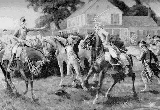
Nathaniel Woodhull is captured by the British and dies from his wounds at the house depicted below which was located in the Dutch village of New Utrecht, now Brooklyn. He is buried at his home in Mastic.
1779
Richard Floyd (British Loyalist), relocates to New Brunswick, Canada in October as England lost the Revolutionary War.
1780
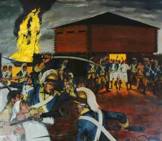
The Battle of Mastic, using whale boat warfare. On November 21, 1780, Colonel Benjamin Tallmadge and his dragoons, 80 strong, rowed across the Long Island Sound under cover of darkness from Fairfield, Conneticut to Mt. Sinai, New York. The next day they proceeded due south to the Mastic Peninsula, captured and burned down the Manor of St. George, which the British had turned into a fort. On their march back with captured soldiers, Tallmadge stopped in Coram and ordered the burning of 300 tons of hay which the British had been stockpiling for the winter. They then returned to Connecticut.
Samuel Carmen Sr. purchases the mills along the lower Carmans River and later opened a store, tavern and Inn. Over the course of the next century, the Carman family became quite wealthy and influental, and , by the mid-1800s, owned much of the land on the west side of Carmans River. Sam Carman Jr. had 12 children; in the 1840s, one of them, Joseph Henry, was given about 30-acres that included Squassux Landing. -Marty Vanlith
1783
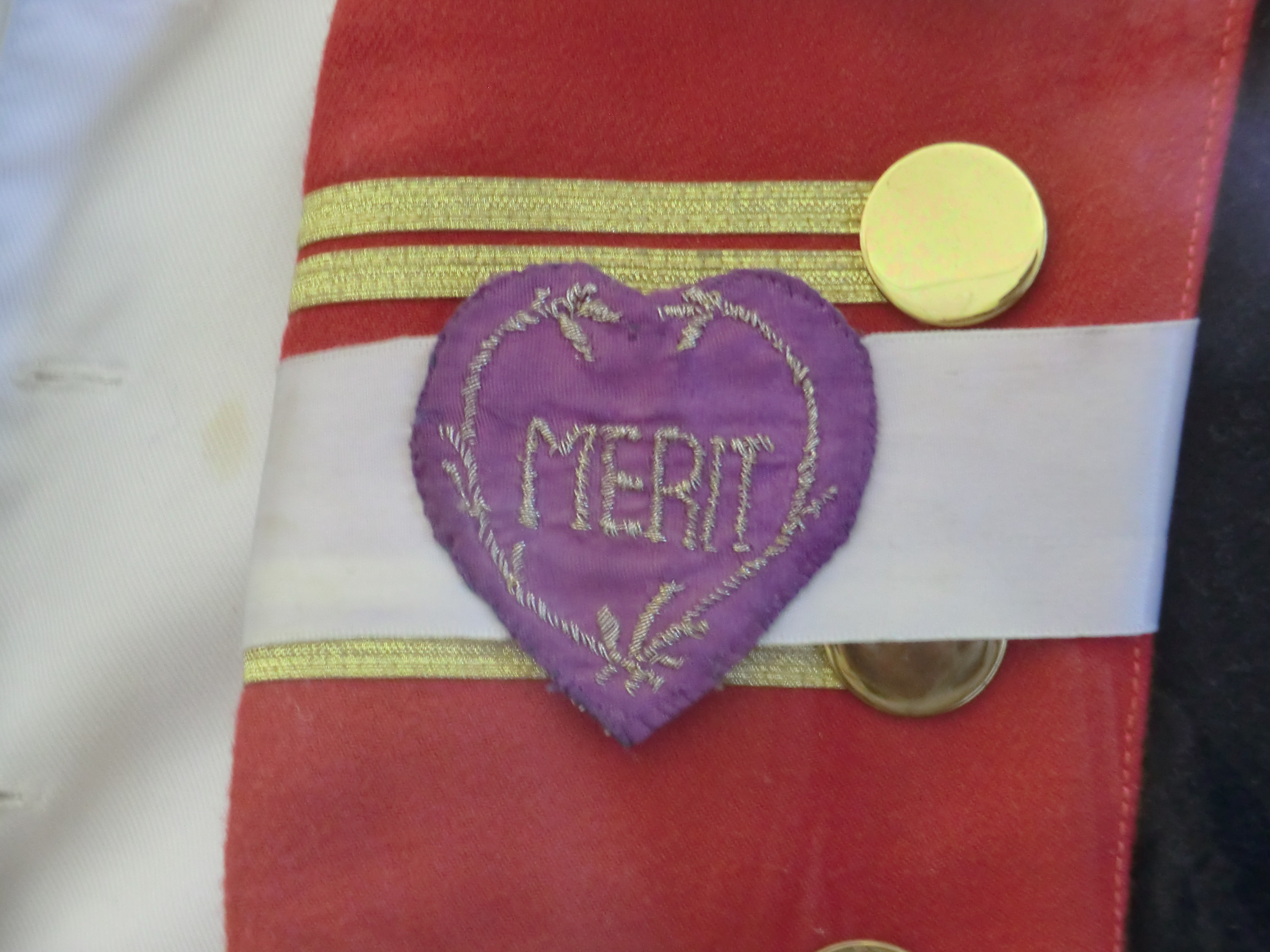
After suffering much damage from the British occupation, William Floyd returns to Mastic to rebuild his estate. On May 3, Gen. George Washington presented the "Badge of Military Merit" (later to become the Purple Heart) to Sgt. Elijah Churchil of the Continental Army citing him for gallantry in action in November of 1780 at Fort St. George (Manor of St. George) in Mastic.
1784
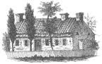
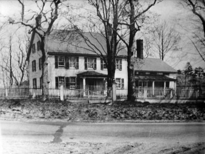
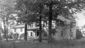
The original Woodhull Estate, believed to have been located between Hemlock and Daisy Drive in Mastic Beach, is destroyed by fire during the month of April. It would later be rebuilt by his widow Ruth Woodhull at the corner of Corn Ct. and Washington Drive in Mastic Beach and is the structure commonly pictured in Postcards like the one below. The second estate house was demolished in the 1930's.
1789
William Floyd elected to the First United States Congress (1789-1791)
1790
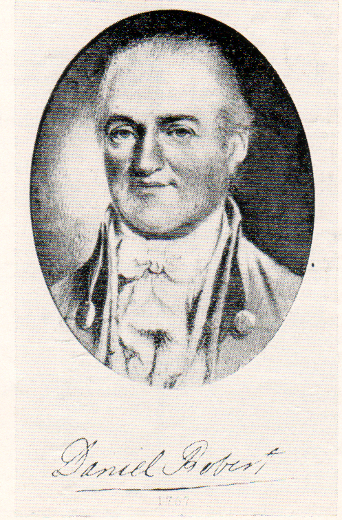
Dr. Daniel Robert who had married into the Tangier Smith Family, moves into the Richard Floyd Estate and begins running the Pattersquas property farm. In October 1779, Richard Floyd (British Loyalist), relocates to New Brunswick, Canada, as England lost the Revolutionary War.
1791
Thomas Jefferson and James Madison, good friends of William Floyd, visit his estate.
Early 1800s
1803
At age 63, William Floyd leaves Long Island with his family to establish a new home in Westernville, New York. Upon his death in 1821, he leaves the Mastic Property to his son Nicoll Floyd, II.
1813
The Brookhaven Township is divided into school districts for the various villages and hamlets .....Thomas R. Bayles, History of Patchogue
1827
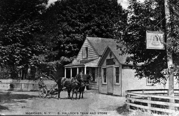
The Moriches Post Office was established with James M. Fanning as postmaster. Originally located in a hotel conducted by the Fannings, it would later be moved to the country store of Edmund Hallock in 1837.
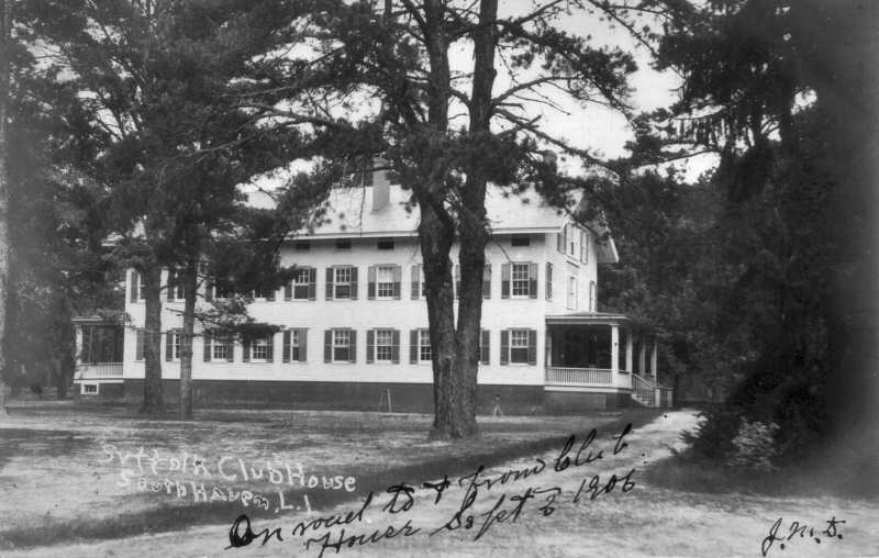
The Suffolk Club, now Southaven County Park is formed by Daniel Webster, Martin Van Buren and others. The property is first leased then purchased from the Carman Family and utilized as a private hunting and fishing preserve located just north of the "goin-over". A wooden bridge over the Carmans or Conneticut river and running to the area known as Yaphank.
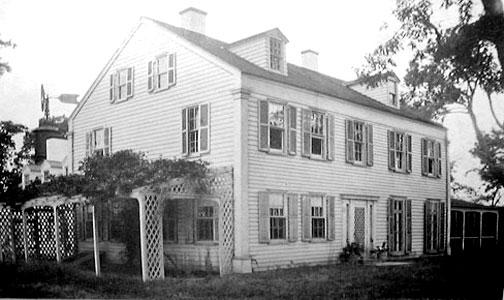
1830
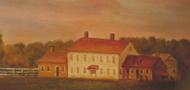
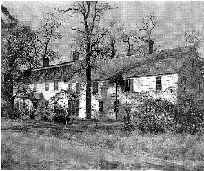
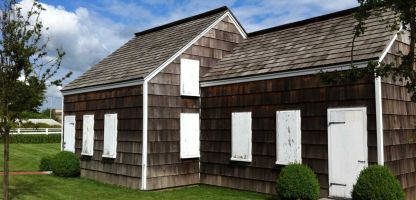
An Early-American home that would become one of the first preservation projects of the Mastic Peninsula Historical Society. The Murray House stands as a tangible link to the domestic life of the early 19th century. The Society documented its restoration.
The Floyd-Murray House, the Petty House, located on the north side of Montauk Hwy at the Southport Shopping Center. It is recognized as an residence area that provided shelter for William Floyd Estate workers. In July of 2012 the house was declared a landmark by the Town of Brookhaven. Efforts are being made to have NYS and the federal govt recognize the house as a landmark.
Late 1800s
Wealthy families from New York City discovered Long Island's South Shore as a destination for summer leisure. The arrival of the Long Island Rail Road extended the region's reach, connecting Mastic and Shirley to the broader metropolitan area.
1835
The Roberts Family, in-laws of the Smiths, take ownership of the Richard Floyd Pattersquas estate with the drafting of a formal deed which is held privately and not filed until the year 1883.
1841
Nicoll Floyd moves in with daughter Catherine Floyd in the Nicoll Floyd homestead located just north of the William Floyd Estate (old Mastic house). This was just 10 years prior to his death in 1851. The homestead, called "Taupeonk", was located just south of Moss Lots. Currently a private residence.
1842
John Gelston Floyd, grandson of Colonel William Floyd, returns to Mastic to run the William Floyd Estate and also serving as a Suffolk County Judge and New York Senator. By 1854, he had already begun selling off parts of land holdings surrounding the estate grounds.
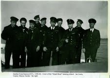
1849
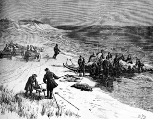
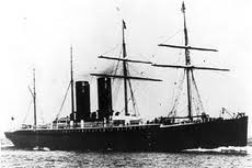
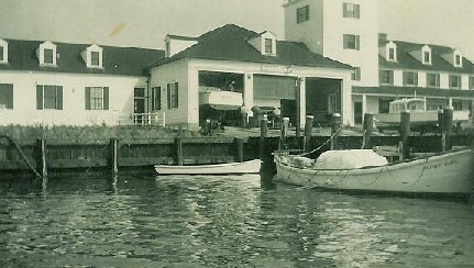
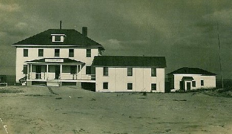
Moriches Life Saving Station established, one of three on Fire Island in this area. These stations were built to make water rescues when ships ran aground in the surf or off shore. This station served until 1954. The photo below is the "SS Oregon" which went down off Fire Island in 1886.
1862
The Great Fire of 1862 started in Smithtown, burned south to the Moriches Bay, and caused severe damage to local area property.
1871
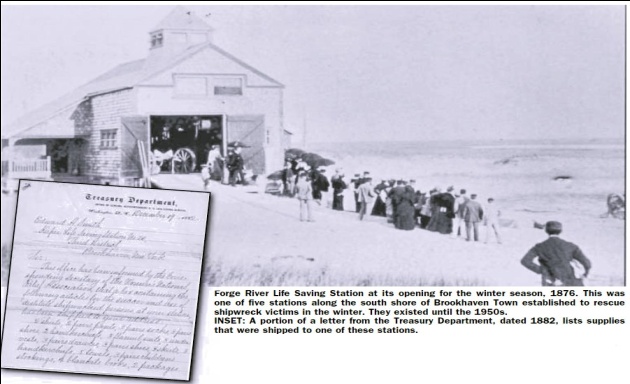
Forge River Life Saving Station established on Fire Island opposite the mouth of the Forge River. Existed until 1948. The ship the Charlie Hickman ran aground in 1884 one half mile east of this life saving station. The rescues were handled by all three life saving stations.
1872
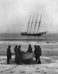
Smith Point Life Saving Station established on Fire Island opposite Smith Point. Existed until 1937. The photo below is the "Bessie White" which ran aground off Smith point in the 1922. The Smith Point Station was not in service at this time. The crew managed to launch life boats and were able to make it to shore.
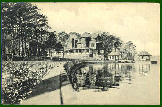
1880
The large and extravagant estate known as "Moss Lots" is built by William Buck Dana for his wife Kitty Floyd Dana. William Dana was a lawyer and instrumental in dividing up the Floyd Property among his five children. The estate was located in the section now known as Old Mastic. East end of Riverside Dr. and the southern end of Ocean View Dr. and was given historic status by the Town of Brookhaven.
August Floyd homestead established...located in the Ospey Point area. End of Wavecrest Dr., Mastic Beach
1881
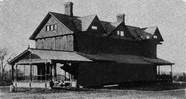
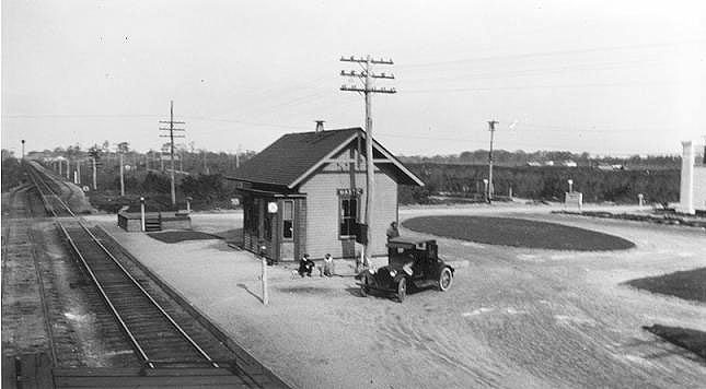
The South Side Railroad, now the LIRR, comes to Mastic. With a station put in on the east side of Mastic Road and remained there until 1960 when the station was moved to Shirley. You can see how stuned the trees are in the background, the result of the great fire of 1862.
1896
On October 9th, Walter T. Shirley, real estate developer, is born in Brooklyn, New York. Later, in the 1930's, he would develop the community of Shirley, L.I., named after himself.

Frank and Hannah Lawrence buy 225 acres located in Mastic Beach between Pattersquas and Odells creek, which became known as the Lawrence Estate.
Early 1900s
The communities of Moriches, Mastic, Mastic Beach, and Shirley grew as working- and middle-class families established year-round homes along the South Shore. Local civic organizations, churches, and schools became the backbone of Tri-Hamlet community life.
1911
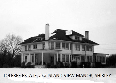
Tolfree Estate (Island View Manor), built by Fred J. Quimby as a spec house for his ill fated Tangier development. It was used by a Rose Quinby until the early 1920's when the Smiths repossessed the land they sold to Quinby's Tangier Manor Corporation. It was soon resold in 1922 to Edward and Aline Tolfree. The estate was purchased by the Cutro Family after World War II and used as a night club where such celebrities as Tony Bennet (pictured below) would appear in the early 1950s

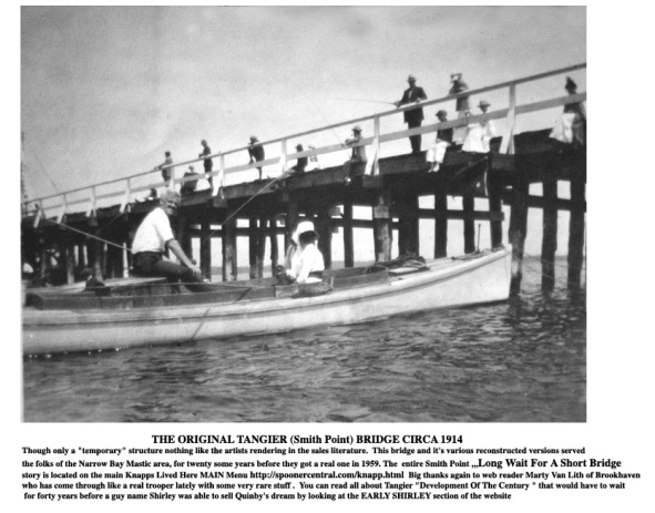
Real Estate investor/developer Fred Quinby has first wooden Tangier Bridge built to cross from Smith Point to Fire Island
1912
Author Henry Lanier purchased the Richard Floyd Estate also known as Pattersquas and "Doctors Point". Henry was the son of poet Sydney Lanier and the first person outside the Floyd and Robert's families to own the Pattersquas estate.
1916
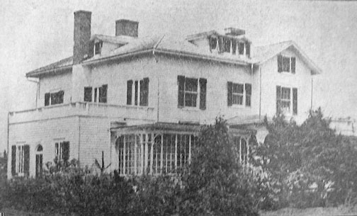
J.F. Knapp buys property from the Lawrence Family that would become known as the Knapp Estate and Mansion. The estate was located south of Neighborhood Rd and east of Pattersquash Creek in Mastic Beach. It would later be purchased by St. Jude's church in 1950, destroyed by fire in 1959.
1917
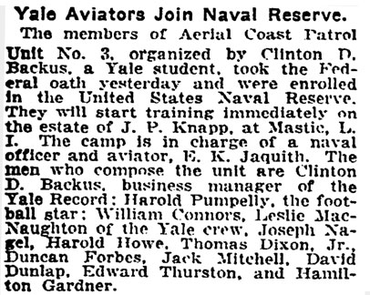
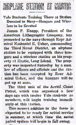
The Third Unit of the Aerial Coast Patrol was established at the Knapp Estate in Mastic Beach.
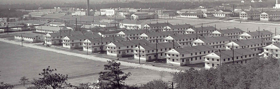
Camp Upton, pictured below, was built in 1917 as an induction and training facility for new soldiers who were to fight in World War I. The camp was named after Major General Emory Upton, a Union General in the Civil War. In 1944, Camp upton was used as a hospital to treat wounded veterans of the war. It also served as a Prisoner of War Camp, when in May of 1945, 500 German prisoners were sent to Camp Upton.
1918
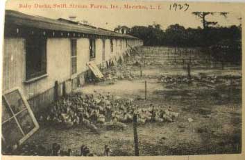
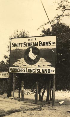
Walter T. Shirley is stationed at Camp Upton during World War I, and gets his first glimpse of the land he would later purchase and develop. Joseph Allen Titmus and Josiah Smith Robert established the "Swift Stream Duck Farm" on both sides of the Forge River in Mastic and Moriches.
1919
Jurgeliewicz Family Duck farm on Barnes Road is established, one of several duck farms in the area.
1920
Radio broadcasting takes off and a transmitter is stationed at Radio Point in Moriches. The golden age of
radio, circa the 1920s, brought an early radio station to the east end of Smith Street in East Moriches.
Run by the Independence Wireless Co., the station housed a spark transmitter used to communicated with
ships off shore.
....Newsday, February 22, 1988
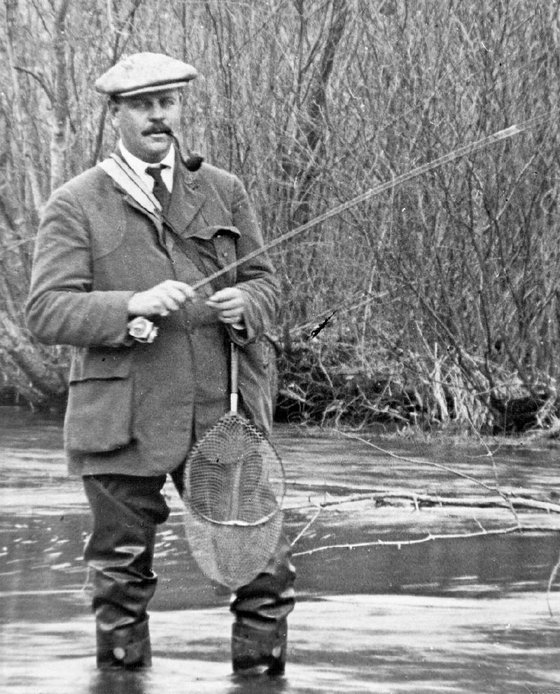
Anson W. Hard purchased the outstanding shares in the Suffolk Club (now Southaven Park) from the other members, and used the property as a private estate. After WW I, Anson's son Kenneth established a hunting and fishing lodge, known as the Suffolk Lodge Game Preserve. It later became Suffolk County's first public park, Southaven County Park. Anson Hard pictured below fishing in the Carman's River on the Hard Estate, circa 1925 ...courtesy of SouthavenBrookhaven.org
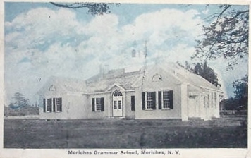
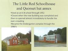
Moriches Grammar School established (currently known as the Little Red School House). Elementary school students from our area attended this first multiroom school. High School students would attend the Center Moriches High School.
1920s
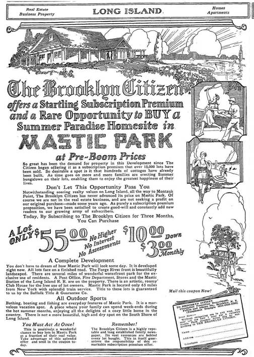
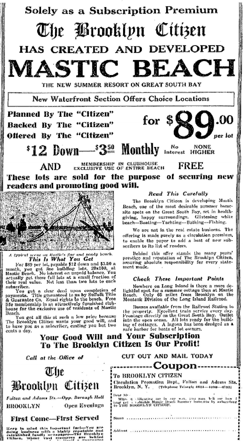
Mastic Park from Montauk Highway to the bay developed by Arthur and Warren Smedback and the Brooklyn Citizen.
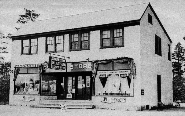
Mastic Park General Store & Post Office is built. Originally owned by the Napolitano family, it would later be sold to Hans Anderson and then to Walter McLeans. The business would later be known as "McLeans Market" in the 50s and 60s. Building still remains as a spanish market and is located at corner of Herkimer St. and Montauk Highway.
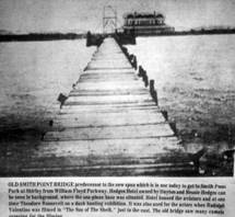
Smith Point Beach used for several desert films. Desert movies were made wildly popular in the 1920s. by Rudolf Valentino's portrayal of The Sheik (1921) & sequel Son of the Sheik (1926). The 1910 bridge's construction that allowed cameras, camels and crew to cross the narrow bay, was supervised by local resident Michael Gillispie of Tangier (now Shirley) for Quinby's Tangier Development Company. According to historian Van Field, it was mainly the movie companies who kept repairing the bridge when it would get torn up by winter ice ....Ken Spooner

1922
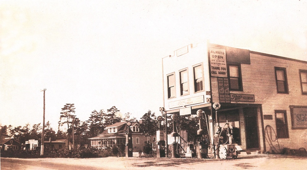
Texaco Gas Station owned by Lewis Parr opens (now Mastic Liquors).
1925
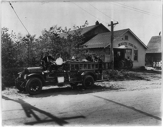
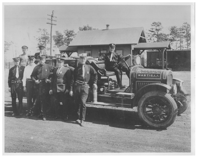
Mastic Fire Department established. It was organized by Russell Ferrer, Anthony Tebbens, Harold Lukert, Joseph Titmus and Thomas Eyton-Jones (1st Chief, in photo with white hat).
1926
Brooklyn Citizen purchases the J.B. Lawrence estate and it's subdivided into lots for sale to the public.
1927
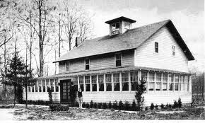
Mastic Beach Property Owners (MBPOA) Clubhouse was built by Arthur Tebbins. In 1928, Mortimer Wahl became the first President of the MBPOA.
 Clubhouse.jpg)
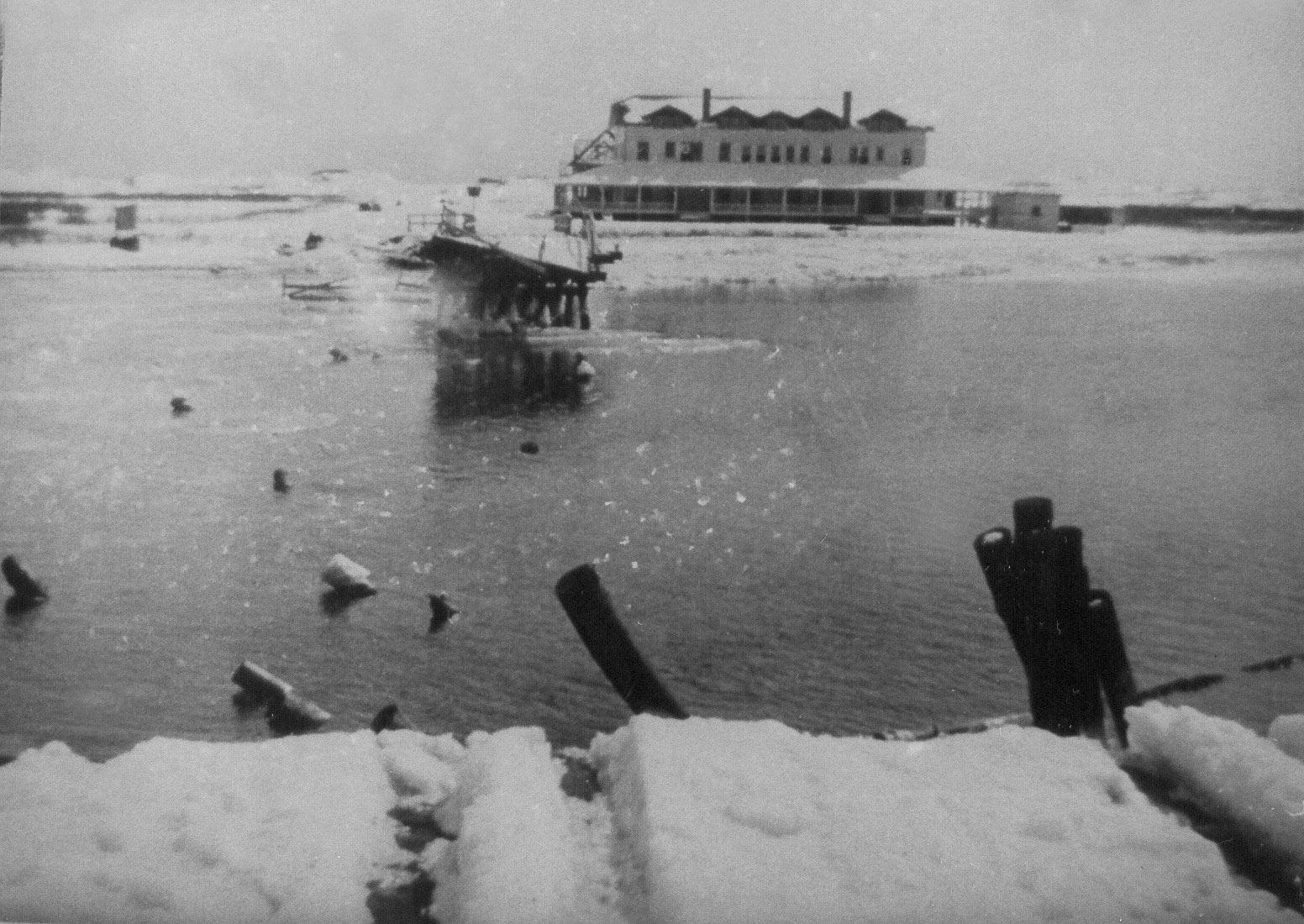
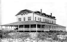
The 15 room Mastic Beach Hotel is built just behind the MBPOA Clubhouse by Paul Schulte.
The Smadback Brothers purchase the Pattersquas Estate and property from Josephine Lanier.
Tangier Bridge destroyed by ice flows. Hedges Hotel pictured across the bay, was destroyed in the 1938 hurricane.
1928
Mortimer Wahl became the 1st President of the MBPOA.
Mid 20th Century
The post-World War II housing boom brought rapid population growth to the Tri-Hamlet area. New developments transformed the landscape, and longtime families who had lived on the peninsula for generations found their community changing around them.
1930
Home Guardian sells the Pattersquas Mansion to Playwright John Howard Lawson.
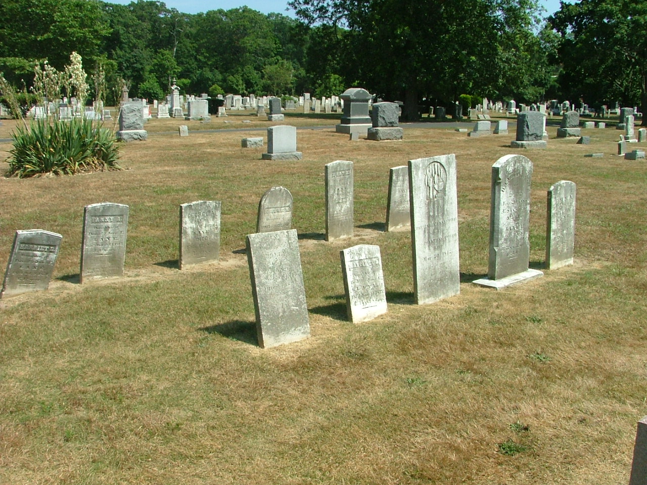
Tombstones in the Lane Family Cemetery, located on the north side of Montauk Hwy at Titmus Drive in Mastic, are moved to the Mount Pleasant Cemetery in East Moriches. The exact spot where the Lane Cemetery was located is still being investigated.
1933
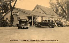
Paul Schulte's Tavern opens with the end of prohibition and is situated along side his corner market. The tavern itself is a converted barn from the Knapp Estate.
1999
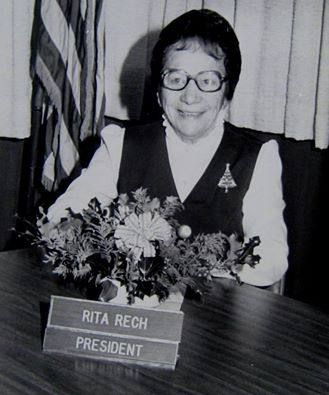
Rita Rech founded the Mastic Peninsula Historical Society with a mission to identify, document, and preserve the rich but rapidly disappearing history of the Tri-Hamlet communities. The Society immediately took on its first projects: advocating for the Murray House and assisting the local library with historic photograph identification.
2000s–Present
The Society produced its signature "Map of Historical Sites" for the Tri-Hamlet area, distributing over 15,000 copies to residents, students, historians, and tourists. Publication of an ongoing local history booklet series began. The Society continues to advocate for the Lane Family Cemetery and other threatened historical sites.
2013
Wood from General Woodhull's home which was sent to the Hamptons (see 1938 entry) was returned to the Village of Mastic Beach to be reused in a visitor's center.
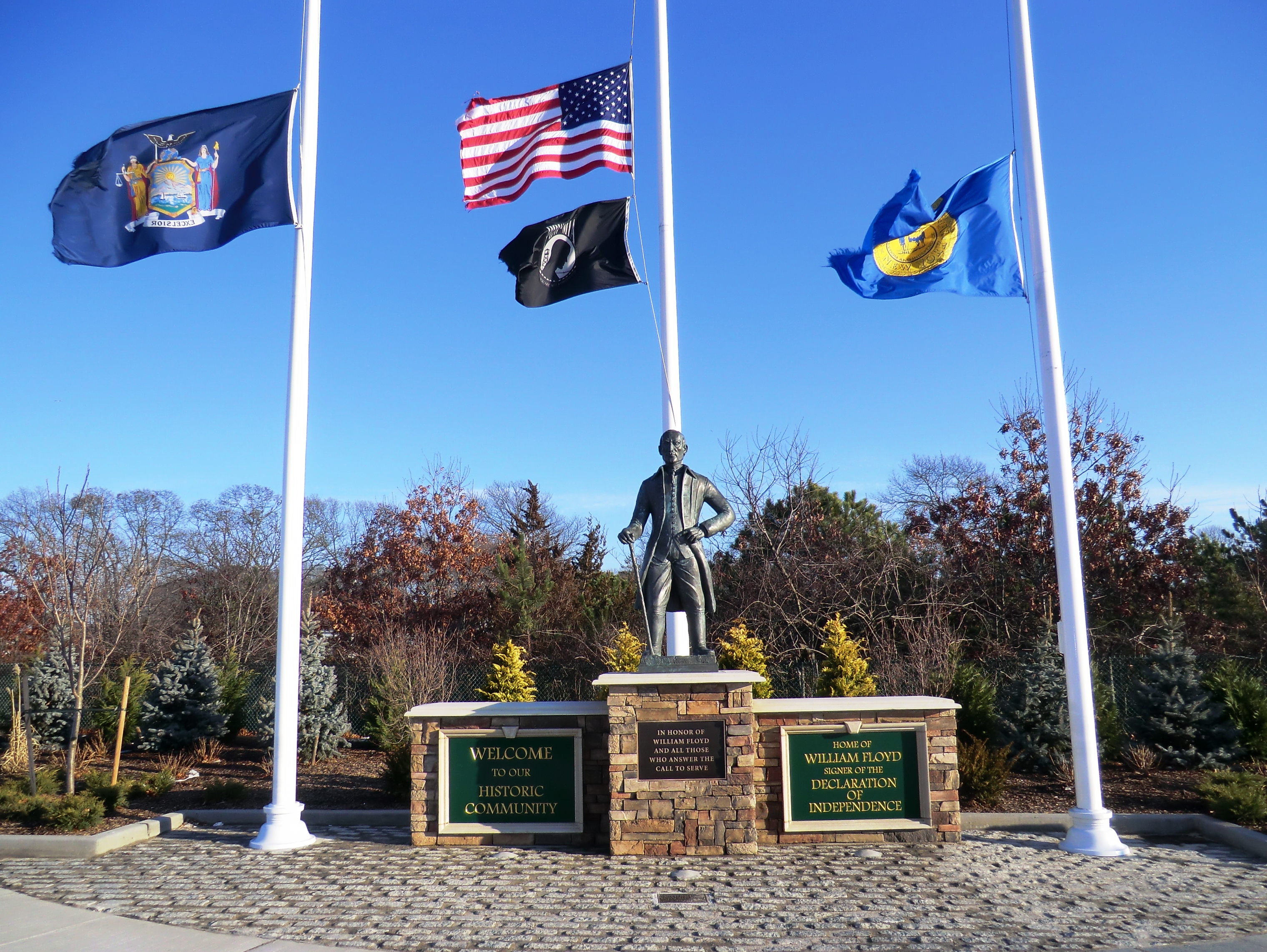
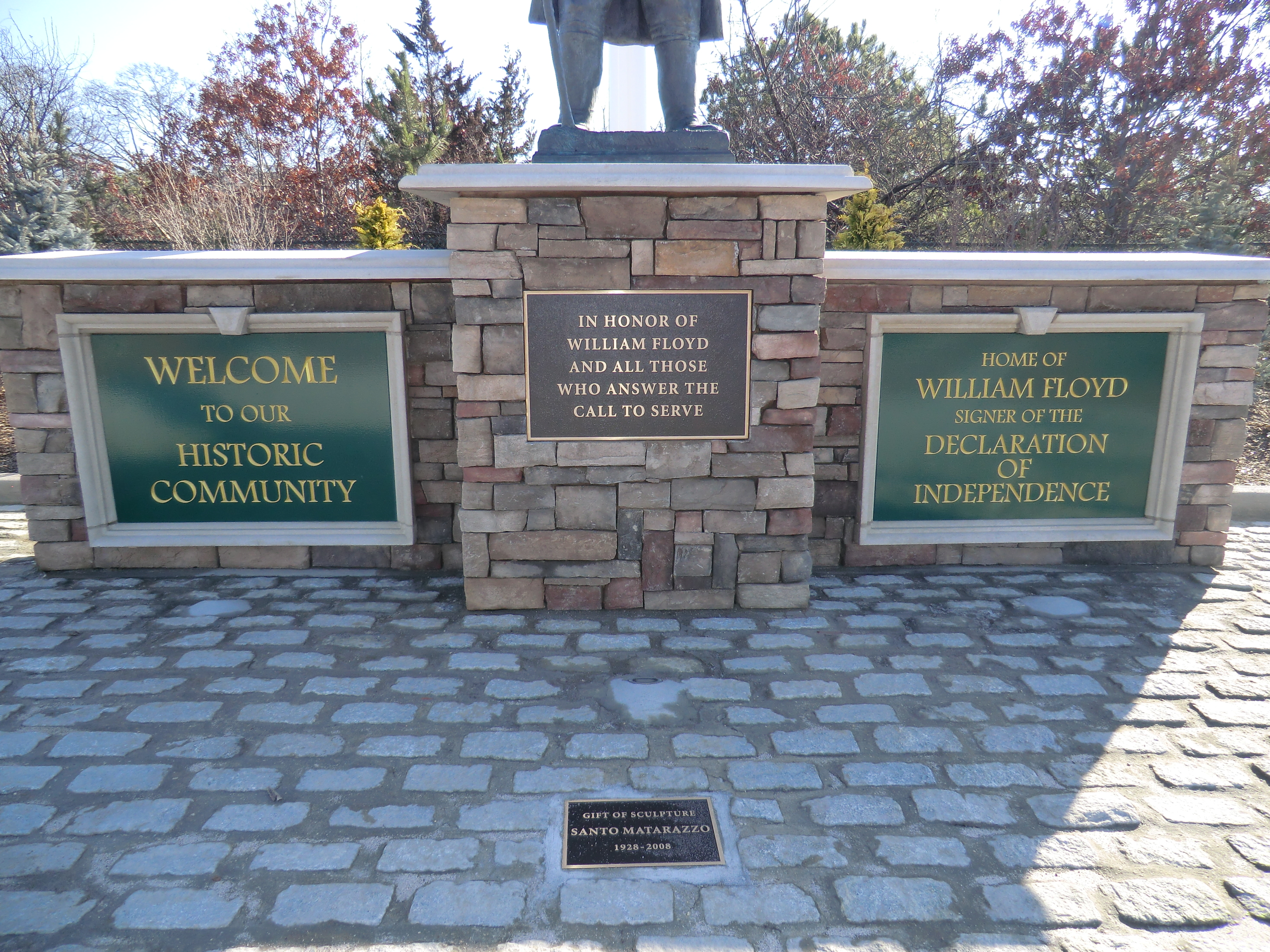
William Floyd Statue Dedication at the new Tri-Hamlet Village Square on December 13th. The Statue was originally located at the Mastics - Moriches - Shirley Community Library at the front north west corner facing Roberts Road. Originally designed and built by local resident Santo Matarazzo (1928-2008).
2015
Suffolk County and the Natural Resources Conservation Service (NRCS) purchase, rehabilitate and preserve 62 wetlands parcels along the shores of Mastic Beach
2016
Mastic Beach votes to dissolve village in November elections

Village of Mastic Beach officially closes its doors on Friday, December 29th after an earlier election was held to dissolve the municipality.
2017
AMF Shirley Lanes bowling facility closes in August.

2018
Mastic Beach Volunteer Ambulance Company opens new 9.5 million facility on Neighborhood Rd. A ribbon cutting ceremony was held in September with operations starting in October
2019
Voters approve new Mastic - Shirley Sewer District referendum.
Mastics - Moriches - Shirley Library announces purchase of the Mastic Beach Village facility located on Neighborhood Rd during the month of May, with plans to operate a branch library.
This timeline will grow as we continue our research. Have information about local history to share? We'd love to hear from you.
Contact Us with Historical InformationPoints of Interest
These are some of the historically significant locations documented by our Society. Download our free map for a complete guide.
A circa-1830 Early American home — one of the first preservation projects of the Society. A rare surviving example of early domestic architecture in the Mastic area.
Our current focus project. This historic burial site is at risk and the Society is actively advocating for its protection and proper recognition.
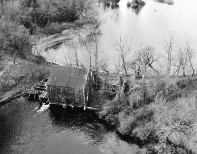
The bay and its inlets shaped the economy and culture of the peninsula for centuries — from indigenous fishing to colonial trade and early tourism.
Our free map documents all identified historical sites in the Mastic, Mastic Beach, and Shirley area. Over 15,000 copies distributed.
Download Free PDF →